Understanding Garden Land Surveys
Garden land surveys serve as an essential tool in the planning and design of landscaping projects. They provide accurate measurements and detailed mapping of the natural and artificial features within a garden space. Whether you are a homeowner looking to enhance your outdoor area or a landscape architect working on a large estate, understanding the intricacies of a garden land survey can greatly influence the success of your project. A comprehensive Garden land survey can identify site constraints, optimize space, and inform various design decisions.
What is a Garden Land Survey?
A garden land survey is a precise and detailed assessment of the topography and features of a garden area. This survey involves measuring land contours, identifying significant features such as trees, water bodies, and buildings, and documenting dimensions and elevations. The data collected through this survey creates a plan that aids in the development and landscaping of the garden. Essentially, it captures the area’s unique characteristics and provides a foundational knowledge that is crucial for any landscaping endeavor.
Importance of Garden Land Surveys
Garden land surveys play a critical role in ensuring that landscaping projects are executed successfully. They allow for effective planning, help in understanding the existing conditions of the site, and contribute to the design process by ensuring that proposed changes fit harmoniously with the natural features of the land. This careful consideration is particularly important in urban areas where gardens may have to work around existing infrastructures.
Applications in Landscaping and Design
There are numerous applications for garden land surveys in landscaping and design, including:
- Planning Layouts: Understanding the contours and natural features ensures that plants, paths, and other elements are placed optimally.
- Identifying Drainage Issues: Surveying helps determine the flow of water within the garden, allowing for better management of water and soil.
- Enhancing Biodiversity: By mapping existing flora and fauna, gardeners can design spaces that promote a healthy ecosystem.
- Compliance with Regulations: Surveys can be used to ensure that landscaping plans adhere to local regulations regarding land use and development.
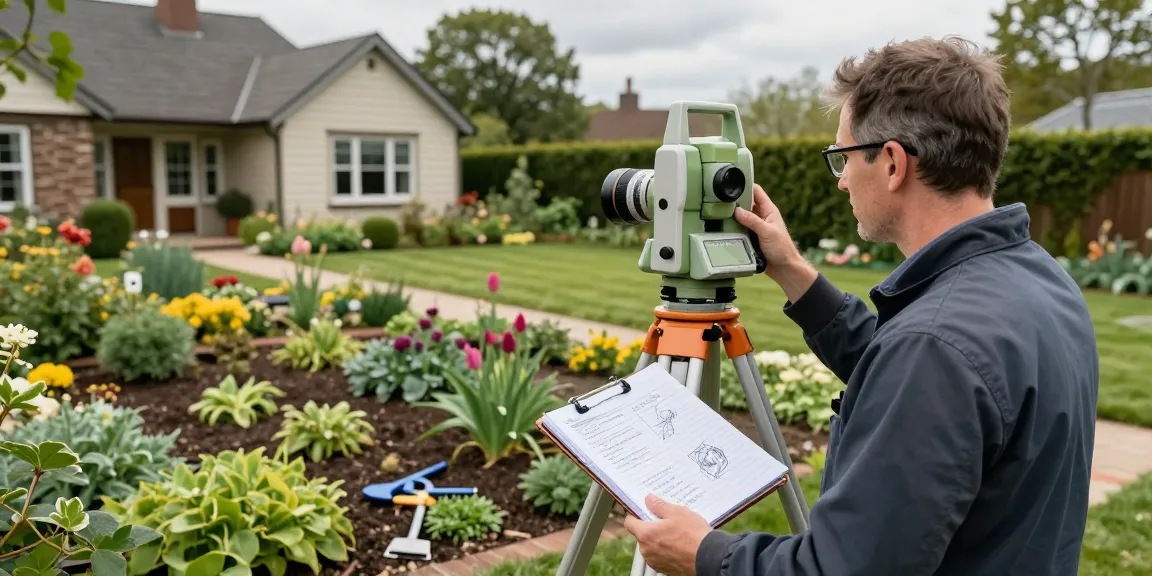
Equipment Used in Garden Land Surveys
Modern Surveying Tools and Technologies
The advancement of technology has significantly improved the accuracy and efficiency of garden land surveys. Surveyors today utilise an array of tools, including:
- Total Station Instruments: These combine a theodolite for measuring angles with electronic distance measurement (EDM) capabilities, allowing for precise measurements.
- GPS Surveying Equipment (GNSS): Provides accurate point positioning, especially useful on larger sites or those with complex topographies.
- 3D Laser Scanners (LiDAR): These capture millions of data points rapidly, ideal for creating detailed, three-dimensional models of the terrain.
- Drones (UAVs): Equipped with high-resolution cameras, drones can access hard-to-reach areas, making them invaluable for mapping extensive garden areas.
- Digital Level Instruments: Utilised for measuring vertical height changes accurately.
Comparing Traditional vs. Digital Methods
Traditional surveying methods often involved manual tools and extensive time to gather data. While still valuable, these methods can be less efficient and may lack the precision needed for complex projects. In contrast, digital methods allow for faster data collection and enhanced precision, enabling surveyors to generate accurate models and maps that aid in design and planning.
Utilising Drones for Accurate Mapping
Drones represent a significant development in garden surveying technology. They offer several advantages, including:
- Quick Data Collection: Drones can survey large areas in a fraction of the time it would take ground teams.
- High-Resolution Imagery: Aerial images can provide insights into site conditions that are not visible from the ground.
- 3D Mapping Capabilities: With photogrammetry software, drones can create detailed 3D models that are essential for planning and analysis.
Steps to Conducting a Garden Land Survey
Preparing for the Survey: Key Considerations
Preparation is vital for an effective garden land survey. Before the survey begins, it’s important to consider:
- Site Access: Ensuring that the surveyors have access to all parts of the property is crucial for a comprehensive survey.
- Existing Features: Identifying any existing structures or elements that may affect the survey results helps in planning.
- Permits and Permissions: Ensure that all necessary permissions are obtained, especially in urban settings where regulations may be stricter.
Executing the Survey: Techniques and Best Practices
During the survey, using the right techniques can enhance data accuracy:
- Regular Calibration of Equipment: Ensuring that all tools are calibrated before use can prevent errors in the readings.
- Clear Communication: The survey team should clearly communicate to ensure all necessary areas are covered.
- Documenting Findings: It is essential to take detailed notes and photographs throughout the surveying process to support later analysis.
Analyzing Data Collected: Interpreting Your Findings
Once the survey is complete, the data must be carefully analysed. This process typically involves:
- Creating Topographical Maps: These maps will illustrate the elevation, vegetation distribution, and other key features.
- Identifying Zones: Analysis should identify specific zones within the garden that may be suitable for different plant types or features.
- Integrating with Design Software: Incorporating survey data into design software can facilitate a seamless transition from planning to execution.
Common Challenges in Garden Land Surveys
Identifying Site Constraints and Hazards
One of the primary challenges in garden land surveys is identifying potential constraints, such as:
- Irregular Terrain: Uneven ground can complicate measurements and affect overall design.
- Unseen Hazards: Issues like underground utilities or unstable ground can pose risks that must be identified early.
Navigating Legal Requirements and Regulations
Compliance with local planning regulations can complicate garden land surveys. Surveyors must be aware of:
- Zoning Laws: Understanding the zoning regulations for the area can affect design possibilities.
- Environmental Regulations: Certain features may be protected by law, requiring special consideration during planning.
Addressing Environmental Concerns
Environmental factors play a significant role in garden land surveys. Surveyors must consider:
- Biodiversity: Saving existing flora and fauna is crucial for sustainable development.
- Water Management: Understanding drainage and water flow patterns can prevent future issues related to flooding or soil erosion.
Future Trends in Garden Land Surveys by 2026
Innovative Technologies Transforming Surveying
Looking ahead to 2026, several trends are poised to change how garden land surveys are conducted:
- AI and Machine Learning: These technologies will predict growth patterns and help in developing more efficient landscape designs.
- Augmented Reality: This can help designers visualize how new elements will integrate with existing landscapes before implementation.
Sustainable Practices in Garden Design
As environmental concerns rise, sustainable practices in landscaping will continue to gain traction. Surveys will increasingly focus on:
- Native Planting: Encouraging the use of local plant species to reduce water usage and promote biodiversity.
- Sustainable Materials: Awareness of materials that have a lower environmental impact will shape design choices.
Emerging Market Demands for Precise Surveys
As urban areas expand and garden projects become more sophisticated, the demand for precise and comprehensive surveys will grow. Professionals in landscaping will need to:
- Adapt to New Technologies: Keeping up with advancements in surveying technology will be essential for maintaining competitiveness.
- Continually Upgrade Skills: Ongoing education in design principles and environmental considerations will benefit surveyors.
What is the average cost of a garden land survey?
The cost of a garden land survey can vary based on several factors including the size of the area, the complexity of the landscape, and the required level of detail. On average, homeowners can expect to pay anywhere from £350 to £1,200 for a comprehensive survey.
Who benefits from garden land surveys?
Garden land surveys are beneficial for a variety of stakeholders, including homeowners, landscape architects, real estate developers, and city planners. Each of these groups relies on accurate data to make informed decisions regarding land use and development.
How do I choose a surveyor for my garden project?
When selecting a surveyor for your garden project, consider their experience, qualifications, and references. It’s important to choose a surveyor familiar with local regulations and who uses modern technology to ensure accuracy.
What techniques are available for measuring garden features?
Measuring techniques for garden features can include traditional methods such as tape measurements and more advanced techniques like digital total stations and drones, each offering varying levels of precision and efficiency.
Why is accuracy essential in garden land surveys?
Accuracy in garden land surveys is critical as it informs every aspect of design and planning. Inaccurate data can lead to costly mistakes, such as improper placement of plants or structures, which can compromise the functionality and aesthetic of the space.